# QGIS: Editing tide-corrected CSB data
For Trusted Nodes that prefer to use free and open-source GIS software, the following section describes how to edit tide-corrected CSB data using QGIS, and how to export shapefiles of data that can be shared with program participants.
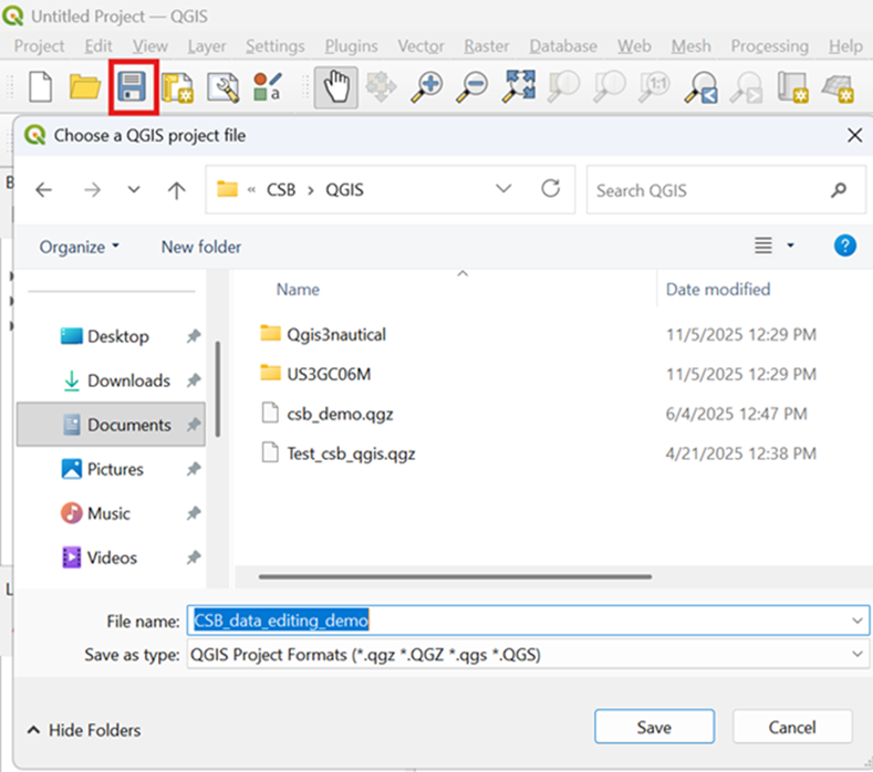
1. Launch QGIS and select **New** under the **Project** tab to create a new project.

2. Click the *Save* icon to name the project and save it in an appropriate location.
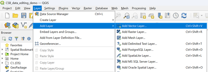
3. Under the **Layer** tab, click on **Add Layer** and select **Add Vector Layer** from the drop-down menu.
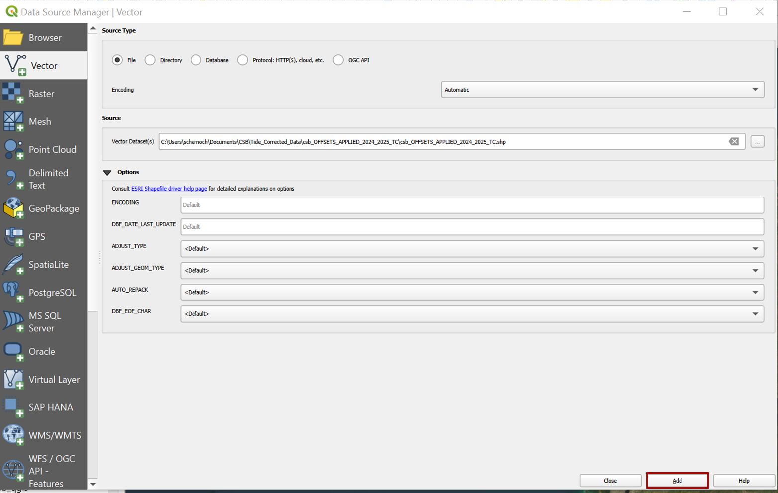
4. In the **Source / Vector Dataset** box, navigate to the .gpkg of tide-corrected data that was output by Pydro. Click **Add** to import the data to the project.
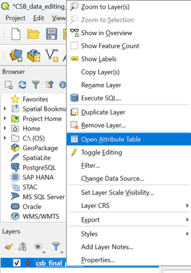
5. *Right click *on the vector layer and select **Open Attribute Table**.
6. The table should contain the columns**: lat, lon, time, depth,** and **platform\_name.** 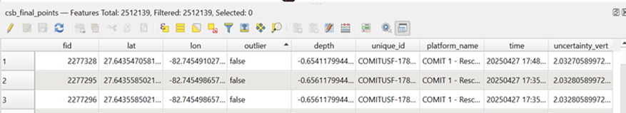
***If your shapefile contains data from multiple participants, you will need to apply a selection query to create individual layers for each participant's data.***
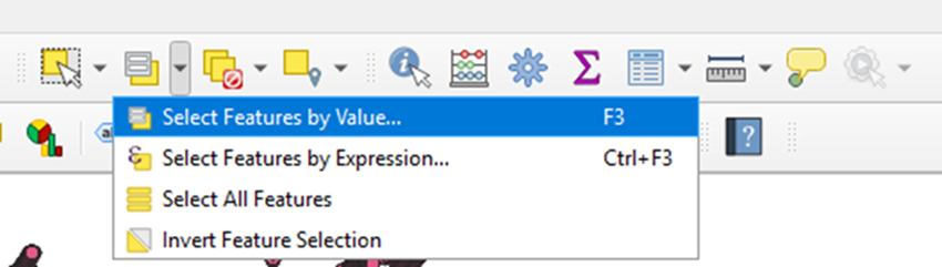
7. Select the CSB vector layer and click on the **Select Features by Value** icon. To select all data points from an individual participant, enter an appropriate term into the *platform\_name* box, and set the filter to *Contains*. Click on **Select Features** to apply the selection.

8. A banner at the bottom left of the window should read out how many points were included in the selection.

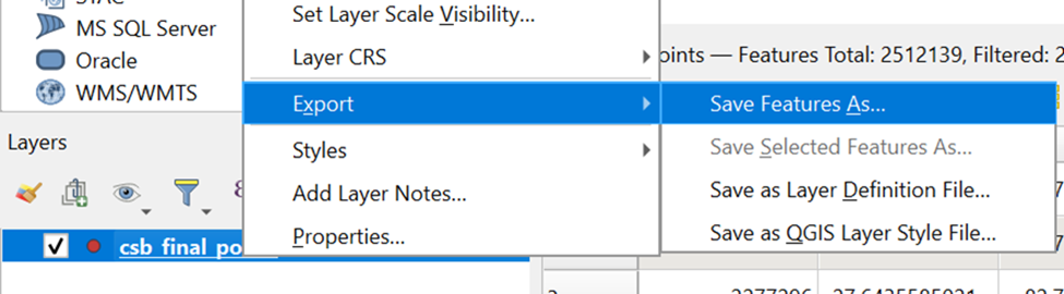
9. *Right click* on the vector layer and under the **Export** drop-down menu, select **Save Feature As**.
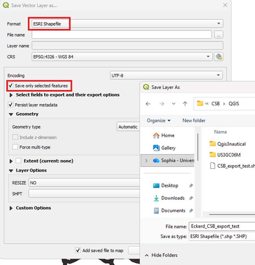
10. Select *ESRI Shapefile* as the **Format** and add an appropriate file name and location. Make sure to check the box to *Save only selected features.* Click **OK** to save.
You now have a shapefile of tide-corrected CSB data that can be zipped and sent to an individual participant.